
Pollock Pines to Carson Valley
—–

Pollock Pines Subdivision
—–

Ranches, Inns, Roads, and Water prior to 1900
D
All images for this chapter, and additional photos not in the original book are shown below.
Photo Gallery for Local Area Maps
-
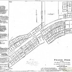
- Pollock Pines Subdivision
-
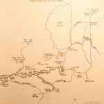
- Pollock Pines to Carson Valley
-
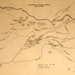
- Ranches, Inns, Roads, and Water prior to 1900
This is a wonderfull site and as a new resident to the area it has been a great way to learn some of the history. The pictures on the local area maps page and several other pages only show up as an “X” is there some setting on my browser that I need to change?
Bill Riedhart
Bill,
I’m still working on some of the pictures. You should be able to view pictures in some of the “chapters”, but the little “red X” might show up for some others. Can you see any pictures at all?
Steve